Urban geology for weekenders: why the cave in Mōʻiliʻili matters
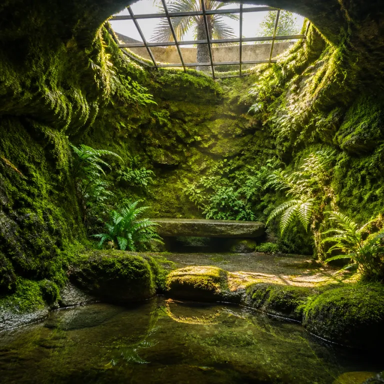
The cave in Mōʻiliʻili sits quietly beneath busy Honolulu streets, shaping the neighbourhood even when most people never see it. This hidden karst cave lies somewhere under the corridor around South King Street and University Avenue, only a few kilometres from Waikīkī and the University of Hawaiʻi at Mānoa. For a short trip focused on city escapes, this underground cave system offers a rare way to understand how geology, water, and construction decisions shape urban life.
Geologists describe the Mōʻiliʻili karst as a limestone cave system carved over long periods as the Mānoa Stream and groundwater moved through the low-lying area. As slightly acidic water flowed through the limestone, it dissolved the rock and created a branching water cave network beneath what is now a dense urban district. Historical accounts and technical reports, including a 1970s engineering study for the Ala Wai watershed, agree that cave water once helped feed wetlands where Hawaiian farmers grew taro and Japanese families cultivated rice, long before modern road building and drainage projects reshaped the Mōʻiliʻili area.
Today, the cave in Mōʻiliʻili is not open to the public, and any remaining access points are controlled by the City and County of Honolulu. Even if you cannot enter the cave directly, a weekend in the surrounding Mōʻiliʻili neighbourhood lets you trace its outline at street level and imagine the underground cave passages below. For travellers who enjoy cave exploration in theory as much as in practice, this is a chance to read the landscape, notice subtle changes in elevation, and picture the hidden karst world beneath everyday city life.
History beneath the pavement: from Manoa Stream to modern streets
The story of the cave in Mōʻiliʻili begins with water and time. Natural erosion by the ancestral Mānoa Stream and persistent groundwater flow sculpted the original karst cave passages, long before Honolulu expanded inland from the coast. As sea level stabilised and engineers later rerouted the Mānoa Stream toward the Ala Wai Canal, water in the Mōʻiliʻili area began to move more through underground channels, turning the limestone into a kind of natural plumbing system beneath the future King Street corridor.
Local historians describe how this cave water once surfaced in springs and ponds that supported taro patches and rice paddies across the Mōʻiliʻili plain. Japanese immigrant farmers relied on dependable Mōʻiliʻili water to cultivate rice fields, while Hawaiian families maintained loʻi kalo, or taro terraces, that depended on steady flow from the stream and the karst. That agricultural landscape gradually disappeared as construction projects, road building, and drainage works buried the wetlands, confined the Mānoa Stream to engineered channels, and transformed the area into a busy urban community.
City and university records now note that South King Street and nearby University Avenue cross parts of the Mōʻiliʻili karst, with voids and former sinkholes documented beneath modern foundations. One geological summary prepared for Honolulu planners in the 1990s simply refers to “a complex system of limestone caves beneath Mōʻiliʻili,” underscoring how much of the cave system remains unmapped. For a weekend visitor interested in urban exploration, walking this corridor offers a layered view of Honolulu, where every manhole hints at a buried karst passage and every culvert recalls the former course of the stream.
To deepen this sense of urban layering during a short city break, you can pair a Mōʻiliʻili walk with another dense neighbourhood itinerary such as an April day tracing music and architecture in Chicago. Both routes show how water, culture, and construction choices leave lasting marks on city streets and influence where people gather, build, and share time.
Culture, community, and the hidden karst under Mōʻiliʻili
While the cave in Mōʻiliʻili is a geological feature, its influence on community life has always been cultural as well as physical. Reliable Mōʻiliʻili water supported generations of Japanese and Hawaiian residents who built farms, schools, and temples in this low-lying area. Many families still share stories of grandparents tending taro and rice near what is now a dense urban corridor, linking the underground cave system to everyday memories of food, work, and neighbourhood life.
Weekend visitors staying near the University of Hawaiʻi at Mānoa can walk from campus down University Avenue to King Street, tracing the approximate edge of the Mōʻiliʻili karst at the surface. Along the way, small eateries, temples, and community centres reveal how the Japanese community and Hawaiian families adapted to the gradual loss of open water as construction intensified. Cafés and izakaya-style restaurants now occupy sites where irrigation ditches once carried cave water toward the future Ala Wai Canal, turning former fields into social spaces where good friends meet after class or work.
For travellers who enjoy slow city escapes with good friends, this walk offers a chance to reflect on how underground cave systems quietly sustain surface life. You might pause at a local shop, share time over a bowl of saimin, and imagine the karst cave voids below that once fed taro terraces and rice paddies. If you enjoy refined small-town weekends as well, you can compare this dense urban layering with the more open waterfront landscapes described in an elegant short break guide to Bayfield, noting how water shapes both places differently and how each community responds.
Planning a weekend around the cave in Mōʻiliʻili
Because the cave in Mōʻiliʻili is not accessible, the best weekend strategy is to build an itinerary that respects the hidden karst while enjoying the surrounding neighbourhood at street level. Start with a morning walk along King Street, where you can observe subtle changes in elevation, older building lines, and drainage channels that hint at the underlying cave system. From there, continue toward the university, using campus viewpoints to understand how the Mānoa Stream valley feeds the lower Mōʻiliʻili area and why water still matters so much to this part of Honolulu.
Short trip planners often ask whether any formal cave exploration tours operate here, but safety and infrastructure constraints mean that cave exploration remains the domain of specialists and researchers. Instead, focus on surface-level experiences that still connect you to the Mōʻiliʻili karst story, such as visiting local museums that explain Honolulu’s water management and the creation of the Ala Wai Canal. Interpretive panels in nearby parks sometimes reference sea level changes, drainage projects, and stream diversions that affected both the Mōʻiliʻili karst and the broader urban coastline.
Between walks, schedule time to enjoy neighbourhood cafés where you can post a Facebook share or build a share Pinterest board about your urban geology themed weekend. When you write captions, explain that the cave in Mōʻiliʻili lies beneath the surface, shaped by ancient water flows from the Mānoa Stream and ongoing groundwater movement. This kind of thoughtful social media storytelling helps other travellers appreciate that a good city escape can include both food stops and quiet reflection on the underground cave landscapes that support modern life in Honolulu.
If you want to extend your interest in water-shaped city breaks, consider pairing Honolulu with an elegant short break in San Pedro, Belize, where coastal lagoons and reef systems play a role similar to the hidden karst here by guiding development, recreation, and community identity.
Safety, access, and responsible curiosity around Mōʻiliʻili karst
Responsible travellers need to understand that the cave in Mōʻiliʻili is officially off limits. The main mapped parts of this karst cave lie beneath public streets and private properties, and any access through city infrastructure is restricted to authorised crews. Entering any underground cave through drainage systems is extremely dangerous and strictly prohibited, even for experienced cave exploration enthusiasts who may be familiar with other water cave environments.
Geologists emphasise that the Mōʻiliʻili karst formed through natural erosion and historical stream activity, which means voids can be unstable when disturbed by construction or unplanned entry. Urban planners monitor the area because changes in cave water levels, especially during heavy rain, can affect foundations, utilities, and road surfaces above the cave system. For weekend visitors, the safest and most respectful approach is to observe surface features, read available geological summaries, and leave underground cave research to qualified professionals who work with proper permits and safety plans.
When you walk through the Mōʻiliʻili area, treat manholes, culverts, and drainage channels as clues rather than invitations. Photograph interpretive signs, create a Facebook share about the history of the Mānoa Stream, and use a share Pinterest collection to gather diagrams that explain how sea level and the Ala Wai Canal reshaped local hydrology. By framing your interest in the cave in Mōʻiliʻili as educational rather than intrusive, you help protect both the karst environment and the surrounding community while still satisfying your curiosity about this unusual urban cave system.
Linking Mōʻiliʻili’s underground story to wider weekend travel
Spending a weekend near the cave in Mōʻiliʻili can change how you plan future short trips. Once you have walked above the Mōʻiliʻili karst and traced the path from the Mānoa Stream valley to the Ala Wai Canal, you start noticing similar patterns in other cities where water, geology, and construction interact. Subtle dips in pavement, clusters of older buildings, and recurring flood spots begin to look like clues to hidden cave water, buried streams, or former wetlands beneath the streets.
For travellers who enjoy city escapes with a strong sense of place, the Mōʻiliʻili area offers a compact case study in how geology shapes community life. You can stand near the corner of King Street and University Avenue, imagine the underground cave passages below, and then look up to see students crossing between lecture halls and small restaurants. That contrast between the hidden karst cave and visible university life makes this district a good choice for thoughtful weekend itineraries that balance leisure, learning, and informal exploration of Honolulu’s layered history.
Back home, you might share time with good friends recounting how Japanese farmers once relied on Mōʻiliʻili water for rice and taro, while Hawaiian families adapted as construction projects changed drainage patterns and stream routes. Use a share Facebook album or a curated share Pinterest collection to connect your Honolulu photos with maps of the cave system and simple diagrams of cave water flow. Over time, these stories help more travellers see that even a quick city break can reveal deep layers of geology, culture, and community beneath the surface of familiar streets.
Key figures and geological facts about the cave in Mōʻiliʻili
- Geological surveys and academic papers describe the Mōʻiliʻili karst as a limestone cave system developed in ancient reef deposits beneath the modern urban area, with multiple interconnected voids rather than a single large chamber.
- The cave in Mōʻiliʻili formed over thousands of years as slightly acidic water from the Mānoa Stream and local rainfall percolated through limestone, gradually enlarging fractures into underground passages and water-filled cavities.
- The Mōʻiliʻili karst extends beneath the corridor around South King Street and University Avenue in Honolulu, placing parts of the cave system under one of the city’s busiest urban routes and near the university campus.
- Hydrologists note that rerouting the Mānoa Stream toward the Ala Wai Canal significantly reduced surface springs in the Mōʻiliʻili area, concentrating more flow through underground cave passages and altering how water moves beneath the neighbourhood.
FAQ about the cave in Mōʻiliʻili and weekend visits
Is the Mōʻiliʻili karst accessible to the public during a weekend trip?
No, the Mōʻiliʻili karst is not accessible to the public, and visitors cannot legally or safely enter the cave system during a weekend stay or at any other time. Any access points are managed by city agencies, and only authorised personnel with proper training and equipment are allowed to enter related infrastructure.
What caused the formation of the cave in Mōʻiliʻili?
The cave in Mōʻiliʻili formed through natural erosion of limestone by flowing water, especially when the ancestral Mānoa Stream crossed this low-lying area. Over thousands of years, slightly acidic water dissolved the rock and created interconnected underground cave passages, turning the subsurface into a classic example of Hawaiian karst.
Where exactly is the cave in Mōʻiliʻili located in Honolulu?
The best-documented parts of the Mōʻiliʻili karst lie beneath the general corridor around South King Street and University Avenue, a short distance inland from Waikīkī and close to the University of Hawaiʻi at Mānoa. Weekend visitors can walk this route to understand the surface expression of the cave system, even though the underground cave itself remains hidden and largely unmapped.
Can I join a guided cave exploration tour in Mōʻiliʻili?
No guided cave exploration tours operate in the Mōʻiliʻili area, because the karst cave is not open to the public and presents significant safety and infrastructure risks. Travellers interested in cave exploration should instead visit established show caves elsewhere in Hawaiʻi or beyond, where access routes, lighting, and safety systems are purpose-built for visitors.
How can I include the cave in Mōʻiliʻili in a short trip itinerary?
The best approach is to design a walking route that passes along King Street and University Avenue, then links to nearby parks, campus viewpoints, and small museums that explain Honolulu’s water management history. This lets you appreciate the influence of the Mōʻiliʻili karst on urban development while enjoying cafés, cultural sites, and relaxed time with good friends at street level, all without disturbing the underground cave environment.